
SURVEYING
What We Do
- All types of construction surveying
- Contour and detail surveys
- Hydrographic surveying
- Aerial photography & surface modelling
- Volume surveys and calculations
- High-definition scanning
- Structural monitoring
- Machine guidance system integration
- Project & relief surveying
- Engineering design QA and drafting
- Precise / sub-millimetre levelling
- Registered - Boundary surveying
UNMANNED AERIAL VEHICLE (UAV) / DRONE
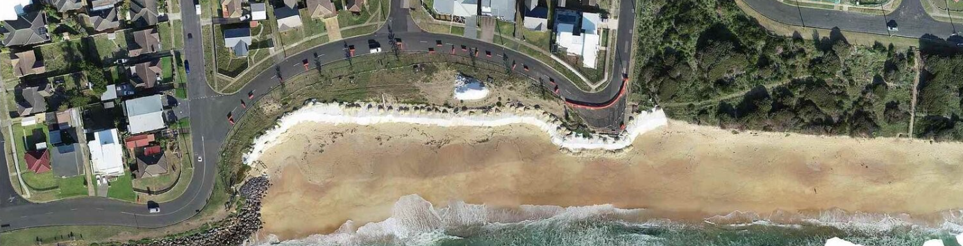
Scope UAV - Image & DEM for Design
When millimetre accuracy isn’t required, UAVs can be used for surveying both small and large areas, being up to 5 times quicker than conventional surveying techniques.
UAVs are also one of the safest options when conducting surveys in hazardous areas such as earthworks and construction sites - they avoid the risk of interaction with mobile plant and machinery.
Applications for the UAV include:
- Land Development – feasibility studies, planning, design, advertising
- Construction – volume reconciliation, progress mapping, asset identification
- Mining – stockpile and void calculations, planning
- Agriculture – drainage analysis, planning, livestock monitoring
- Environmental – Vegetation mapping and monitoring
- Emergency Services – accident scene capture
- Outdoor event planning
LASER SCANNING
High Definition Scanning enables us to capture massive amounts of information in rapid time. Scanners provide a dense point cloud of data to which a mosaic of still images, automatically taken by the in-built camera, can be overlaid to produce a co-ordinated 3D image.
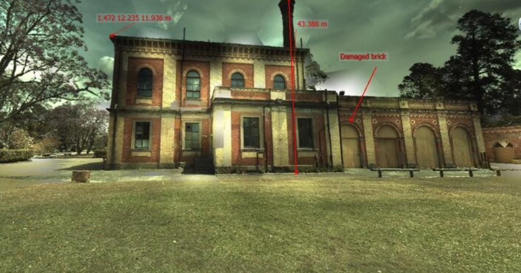
Scope Scanner - Heritage Building Preservation
Scanning is ideal for detail surveys, including:
- Building detail - inside & out
- Heritage building preservation
- Structural deformation monitoring
- Dilapidation surveys
- Machinery (eg. heavy vehicles)
- Pipes
- Columns
- Processing Plants
- Deep excavations
- Dangerous slopes
- Caves
- Surface conformances and clash detection
- Irregular surfaces

RC BOAT - BATHYMETRIC / HYDROGRAPHIC SURVEYS
Scope can also measure the base of a water body using our remote-controlled survey boat. With this data, the shape of terrain below the surface of the water can be determined and used for such things as:
- Determining storage capacities of dams, lakes, voids etc.
- Assessment of riverbank erosion
- Existing surface surveys (eg. structural design and repair, bank stabilisation)
- Conformance of earthworks (riverbank rehabilitation)
- Spill levels and locations
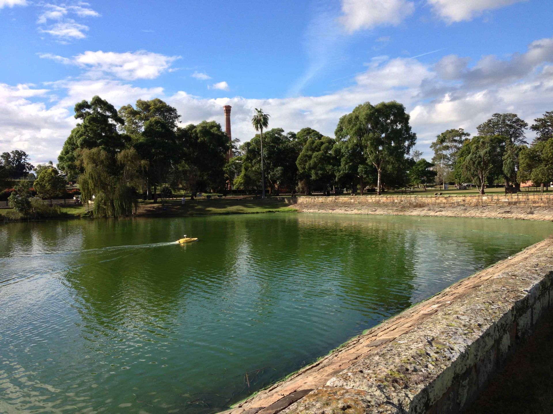
Scope RC Boat - Topography Survey
RC Boat key features:
Depth range: 300mm – 35m
Depth sounder and GPS achieve +/-80mm 3D data
Self-guided option = maximum survey efficiency over large water bodies
Separate sounder - can be mounted on large / manned boats if conditions require
Remote controlled = no personnel on the water
Sturdy Hull Construction = operational in hazardous environments
Battery powered = no fuel spills or noise
Battery life enables up to 14 hours survey without recharging
Scope RC Boat - Survey for Jetty Design
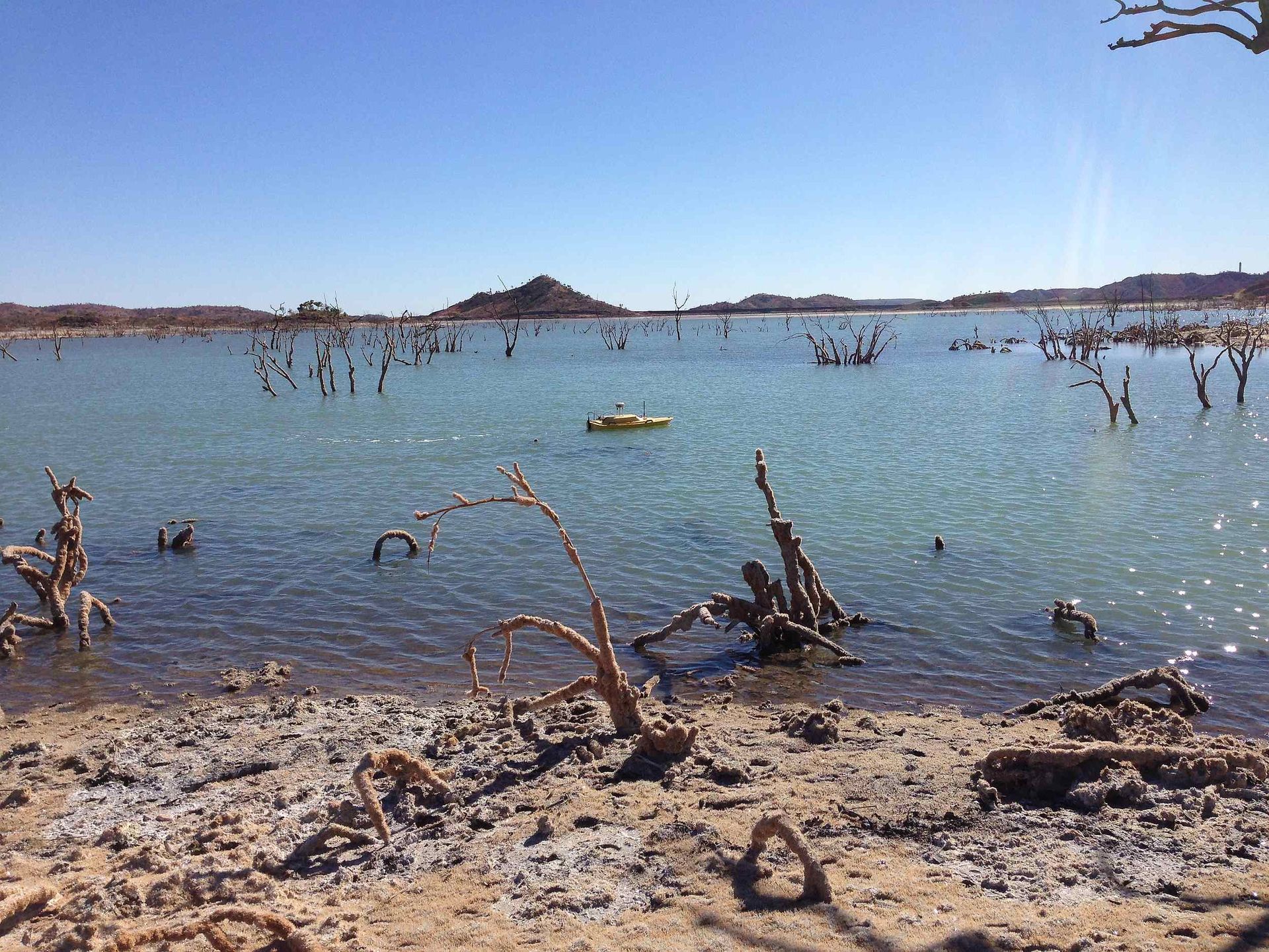
Scope RC Boat - Tailings Dam Storage Check Survey
Need more information? Contact our friendly team today on 02 4934 2868 to discuss your surveying requirements.